Humminbird
Fishfinder Maps Humminbird LakeMaster Plus Minnesota V4 (Includes...
Fishfinder Maps Humminbird LakeMaster Plus Minnesota V4 (Includes...
Couldn't load pickup availability
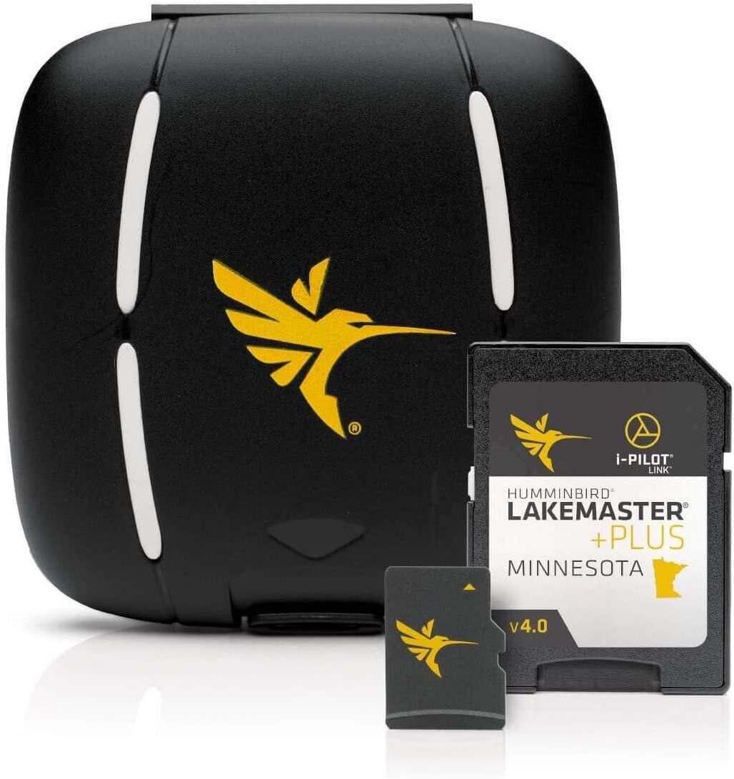
LakeMaster PLUS Minnesota V4 with Lake of the Woods & Rainy RiverLakeMaster PLUS Minnesota V4 microSD Format Electronic Chart by Humminbird. The Humminbird LakeMaster Minnesota PLUS Edition micro map card has added over 1,000 new lakes, 81 High Definition - Surveyed waters to now boast contours for a total of over 3,200 lakes with more than 500 lake maps in High Definition. Newly surveyed waters in stunning HD include: MS River sections: Above Sartell Dam and from Little Falls to Brainerd plus Pool 4/Pepin, Crosby Mine Pit area lakes i.e. Pennington Chain, More Grand Rapids area lakes i.e. Surprise, and Johnson, More Park Rapids area lakes i.e. Bad Medicine, Spider, and Middle Crooked, More Alexandria area lakes i.e. Grant, Brophy, Oscar, and Red Rock plus many more!Features: • i-Pilot® Link™ compatible• Easy to read contours• Depth Highlight Range• Water Level Offset• Shallow Water Highlight• Scrollable Lake ListPLUS has all of the features you've come to love from LakeMaster, but allows for aerial image overlay on High Definition waters. Now you have the ability to use quality aerial photography to view the entry and exits of creek channels, see how far a reef or weed line extends, pick out shallow water rock piles, steep drop-offs and other features of the lake you've been missing from traditional maps. LakeMaster PLUS gives you the freedom to choose how you want to use the aerial imagery.• Aerial Only - This layer shows only aerial imagery and no other map information• Aerial + LakeMaster Contours - This layer shows the colored LakeMaster map and the aerial imagery that extends around the body of water• Aerial + Contours Only - This layer shows the aerial imagery and just the LakeMaster contours so you can still pick out those features in the water while still seeing your depthEach map card Edition covers some of the most popular water bodies in the region and the PLUS series also gives you access to all of the LakeMaster features.Once package has been opened this item is no longer returnable.The PLUS series allows for aerial image overlay on high-definition waters giving you the ability to use quality aerial photography to view the entry and exits of creek channels, see how far a reef or weed line extends, and pick out shallow water rock piles, steep drop-offs or other features of the lake you’ve been missing from traditional mapsVersion 4 includes 55 new or remapped High Definition lakes, such as Lake of the Woods, Rainy Lake, and Rainy RiverIncluded features such as Depth Highlight, Shallow Water Highlight and Water Level Offset can be used exclusively with Humminbird fish findersScrollable lake list allows you to view and research lakes from your Humminbird fish finder on and off the waterLakeMaster cards are compatible with all GPS-equipped HELIX, SOLIX, ONIX and ION Series models, along with select 600-1100 Series models
Fast Shipping
We get your order shipped out within 2-business days and delivered to your doorstep as quickly as possible.
Competitive Pricing
With our dynamic pricing model, our prices are always competitive. Our prices are some of the lowest that you will find on the internet. Rest assured that you're getting a good deal when purchasing with us.
30-day Money Back Guarantee
We are committed to making sure that you leave this transaction satisfied. If you're unhappy with the product for any reason, you may return it back for your money-back or a replacement within 30 days, just return it in the same condition we sent it to you. No questions asked!
Share